Where Canada Lives
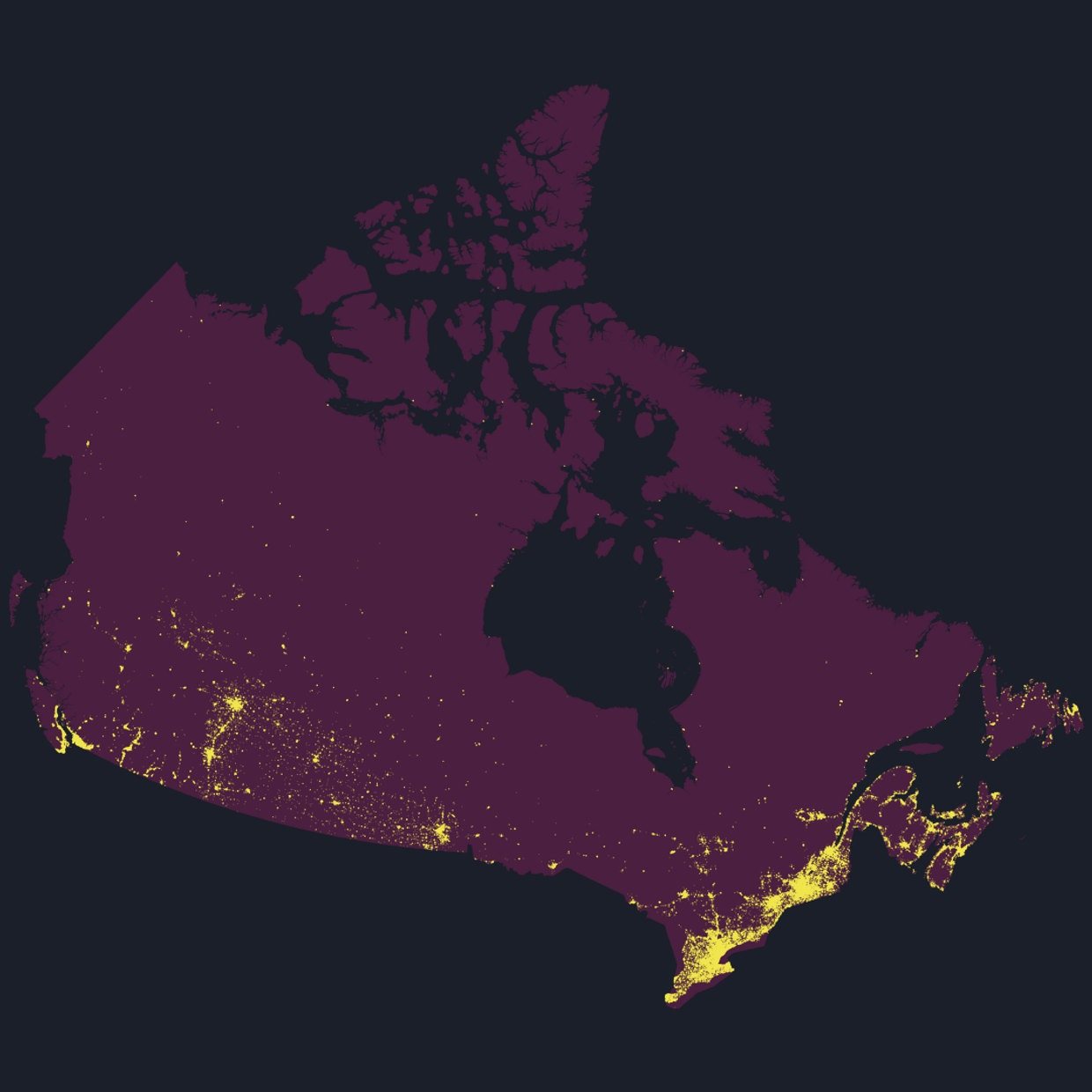
One dot for every 150 people shows where Canada’s population concentrates from coast to coast.
I mapped where everyone in Canada lives. One dot for every 150 people, 241,938 dots in total, placed from a population grid that divides the country into 100 metre squares.
Half of them fit on less land than Metro Vancouver covers. Count only the ground people actually occupy and it comes to 2,409 square kilometres, out of 8.8 million.
That crowded half is spread across the country rather than sitting in one corner. Ontario holds 44.3% of those people, Quebec 23.3%, British Columbia 13.6%, Alberta 10.3%, Manitoba 2.9%, Saskatchewan 1.8%, Nova Scotia 1.7%, Newfoundland and Labrador 0.9%, New Brunswick 0.8%, and Prince Edward Island 0.1%. Those are rounded shares of the crowded half, not of Canada’s population.
The lived-in part runs almost unbroken from Windsor through Toronto and Montreal to Quebec City and out into the Maritimes, with separate knots at Vancouver, Calgary and Edmonton. North of that the map is close to empty.
The figure holds up when the grid is coarsened. Make the squares a thousand times wider and the area holding half the population only grows by a factor of 2.4, so this is a fact about Canada rather than about the resolution of the data.
Source: WorldPop 2020, 100 metre population grid, constrained and UN adjusted. Boundaries from Natural Earth. Drawn in Statistics Canada Lambert. Population is modelled for 2020, not counted, and each dot represents people rather than a household or a building.