Where Australia Lives
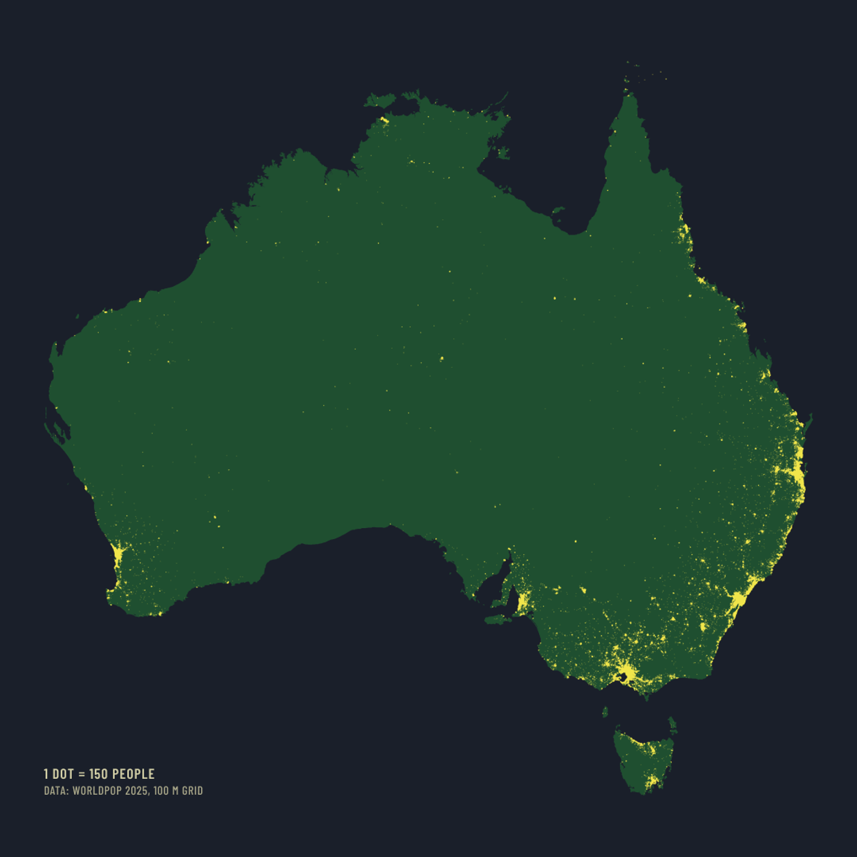
Where a Country Lives, entry two. One dot for every 150 people.
Half of Australia lives in three cities. Greater Sydney, Greater Melbourne and Greater Brisbane held 13.9 million of the country’s 27.6 million people at June 2025 by the Bureau of Statistics’ own estimates, which is 50%. The 2021 Census counted it at 49.9%.
The map shows everyone else too. Each of the 179,026 dots stands for 150 people, placed from a population grid that divides the country into 100 metre squares. Perth and Adelaide are the next two clusters. After that the coast thins out, and the interior holds a scatter of towns with almost nothing between them.
Australians know they live on the coast, and the grid puts a number on it: half the population lives within 13 km of the sea and 86% within 50 km, measured against a simplified coastline. Only 4% live more than 200 km from it.
The grid is modelled from census counts and satellite-mapped buildings rather than counted, so I checked it before trusting it. It holds 26,837,541 people, 2.8% below the Bureau’s June 2025 estimate, and every state lands within 0.67 of a percentage point of its official share. The three-cities figure does not come from the dots at all; it comes from the Bureau’s own city boundaries, so anyone can check it without this map.
The dots off the tip of Cape York are the Torres Strait islands. The coastline I drew does not include them, but the people are there.
Source: WorldPop 2025 (R2025A), 100 metre population grid, constrained. City and state figures: Australian Bureau of Statistics, June 2025 estimates and the 2021 Census. Boundaries from Natural Earth. Drawn in Australian Albers. Each dot represents 150 people rather than a household or a building, and most dots are assembled across many sparse cells, so a single dot in the interior marks people spread over a wide area. Coast distances are approximate. Christmas Island, the Cocos Islands, Lord Howe Island and Norfolk Island are outside the frame.