Sidewalk Forest
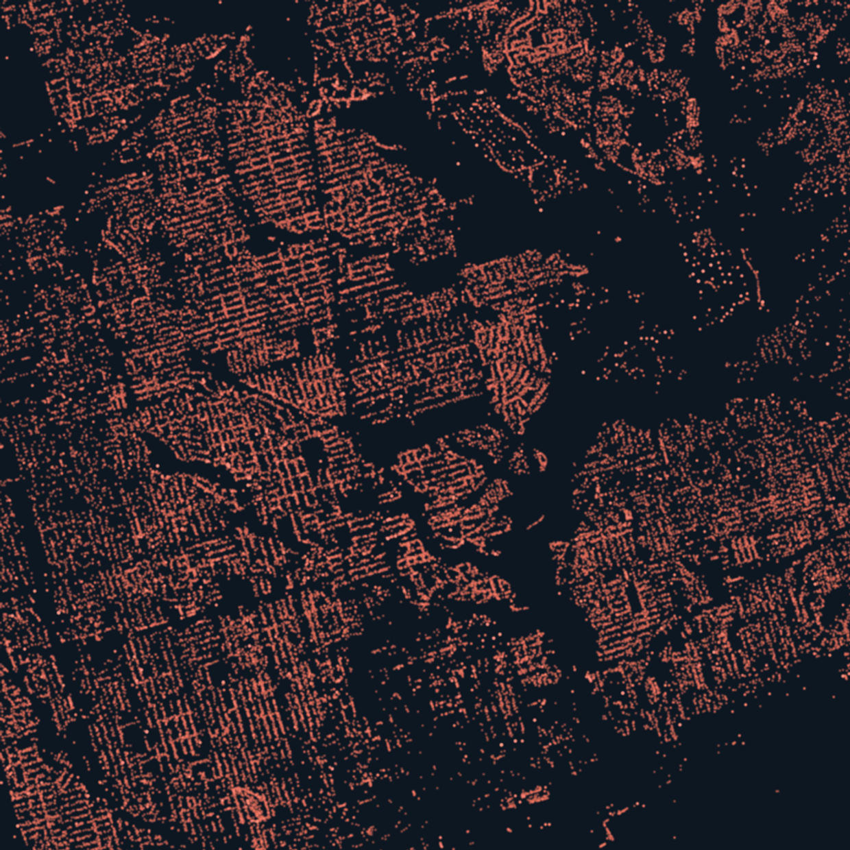
Toronto keeps a record of its 688,335 street trees. I drew every one as a dot, and the picture surprised me.
Toronto keeps a ledger of every tree it plants and tends along its streets. Each entry records a species, a trunk measurement, and a street address. It is a working document, maintained by Urban Forestry crews, full of quirks and the occasional impossible trunk width. It is also, if you squint, a portrait of a second city: a forest laid over the grid.
I wanted to see that forest all at once. So I built Sidewalk Forest, the second guide in the Toronto Micro-Atlas. It renders all 688,335 trees in the city's street tree inventory as one dot each. No aggregation, no heatmap. Every dot is a real tree with a name and an address, and you can tap it and ask.
What the ledger shows
The first thing the map told me is that Toronto loves one tree. 185,621 of the city's street trees are maples, about one in four. No other family comes close.
The second thing is the maple paradox. The single most common street tree in Toronto is the Norway maple: 69,474 of them, a European import so at home here that Ontario's invasive plant council publishes a management guide for it. The sugar maple, the tree on the flag, musters 11,325. On its own streets, the national tree is outnumbered six to one by its European cousin. I knew Norway maples were common. I did not know the ratio until I computed it, and it changed how I walk down my street.
Then there is the ash. Emerald ash borer, a beetle first found in Toronto in 2007, has killed ash here by the hundreds of thousands. The street ledger now counts 9,948, fewer ash than lilacs. The inventory doesn't record absence, but when you light up the surviving ash on a dark map, you can read the loss in the gaps. That chapter is the quietest one in the guide, and the one I kept coming back to.
My favourite finding is smaller. Seven trees in the ledger are the only ones of their species, single entries among all 688,335 rows. Somewhere on Macdonell Avenue in Parkdale stands the city's only street pawpaw. There is one bald cypress, one sour cherry, one pignut hickory. Someone planted each of these on purpose, and the city has been recording them ever since. A database with 688,335 rows still has room for individuals.
One more surprise. At first the map looks lopsided: Etobicoke's west end holds 52,659 street trees, downtown holds just 8,558. But the west end is about six times the size. Measure the two fairly, street for street, and they come out nearly the same, and so does almost every corner of the city. From the leafy outer neighbourhoods to the glass towers of the core, Toronto lines its streets with trees remarkably evenly. I went in expecting a canopy-inequality story. The data declined to tell it.
Go find yours
The guide is a scrollytelling map: the story walks you through the ledger chapter by chapter, then hands you the whole thing as an explorer. Zoom in until the dots separate, search for your street, tap a dot, and the city will tell you what the tree outside your door is and how thick its trunk was when someone last measured it.
Everything comes from the City of Toronto's open Street Tree Data, computed from the June 2026 refresh, so the counts will drift as crews plant and remove trees. The full method and sources are on the page.
Start with the story, or skip straight to the map and find your tree: Sidewalk Forest.